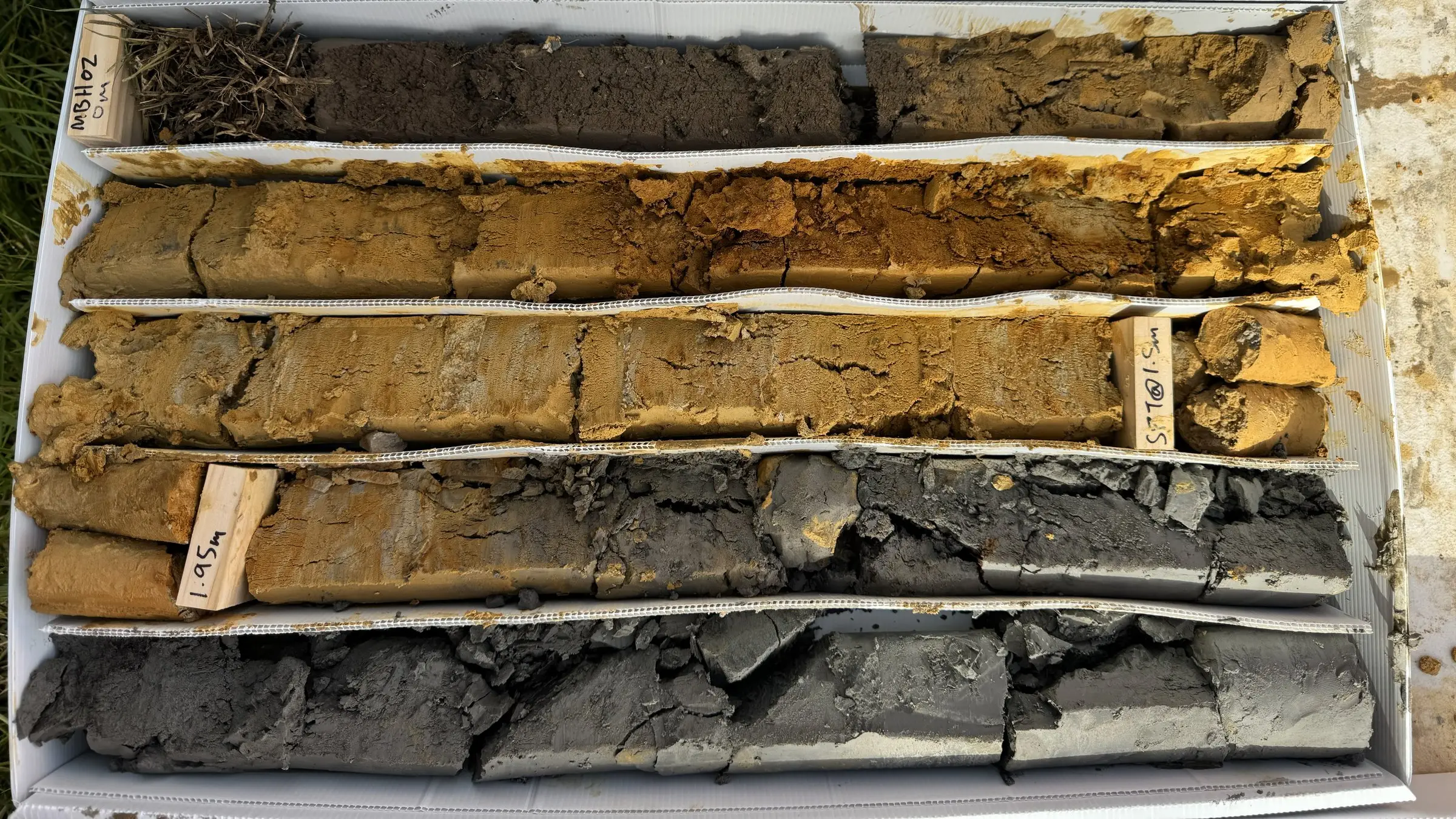
Do I need a liquefaction assessment in Auckland?

Auckland isn’t Christchurch, and most Auckland sites will never see liquefaction. But “most” isn’t “all”, and more owners and developers are now being asked by council, their designer or their bank for a liquefaction assessment. This article explains when you are likely to need one, what it involves and what happens if your site turns out to be at risk.
What liquefaction is, in plain terms
Some soils, mainly loose sands and silty sands sitting below the water table, can lose most of their strength when they are shaken hard in an earthquake. For a short time they behave more like a liquid than a solid. Buildings can settle or tilt, services can break, and ground near streams or the coast can spread sideways towards the open edge.
Clays, firm ground and rock don’t liquefy in the same way. That’s why the type of soil under your site matters far more than the street address.
Is Auckland at risk?
Auckland has lower earthquake shaking hazard than Wellington or Canterbury. Liquefaction can still happen here where the ground is loose, sandy and saturated. The places we look most closely at are:
- Reclaimed land around the harbour edges
- Estuarine and coastal deposits, including land near tidal creeks
- Young river and stream deposits (alluvium), particularly in parts of South Auckland
- Loose sands and sandy silts of the Puketoka Formation, found in southern and western Auckland
Sites on clay hills, which is much of the isthmus and the North Shore, are usually low risk. But “usually” is the reason assessments exist.
What the council maps tell you (and what they don’t)
Auckland Council publishes liquefaction vulnerability mapping on its GeoMaps viewer. It is a regional, desktop-level screening tool based on geology and existing data.
The maps are useful for one thing: telling you whether liquefaction is worth looking at. They are not a site assessment. A site shown as “possible” may turn out to be fine once tested, and a site outside the mapped area isn’t automatically clear. Council’s own mapping notes that a site-specific assessment is needed for things like foundation design.
When you are likely to need an assessment
You will probably need one if any of these apply:
- Your site is in a mapped liquefaction or hazard area and you are applying for consent
- You are subdividing, or building something larger than a standalone house
- The site is low-lying, near a stream, estuary or the coast, or on reclaimed land
- An earlier investigation found loose sands or a high water table
- Council has asked for it in a request for further information
- You are buying a site and want to know the risk before you commit
How we assess it
Most liquefaction assessments follow the same broad steps:
- Desktop review. Geology maps, council mapping, nearby investigations and historical aerial photos, to understand what to expect.
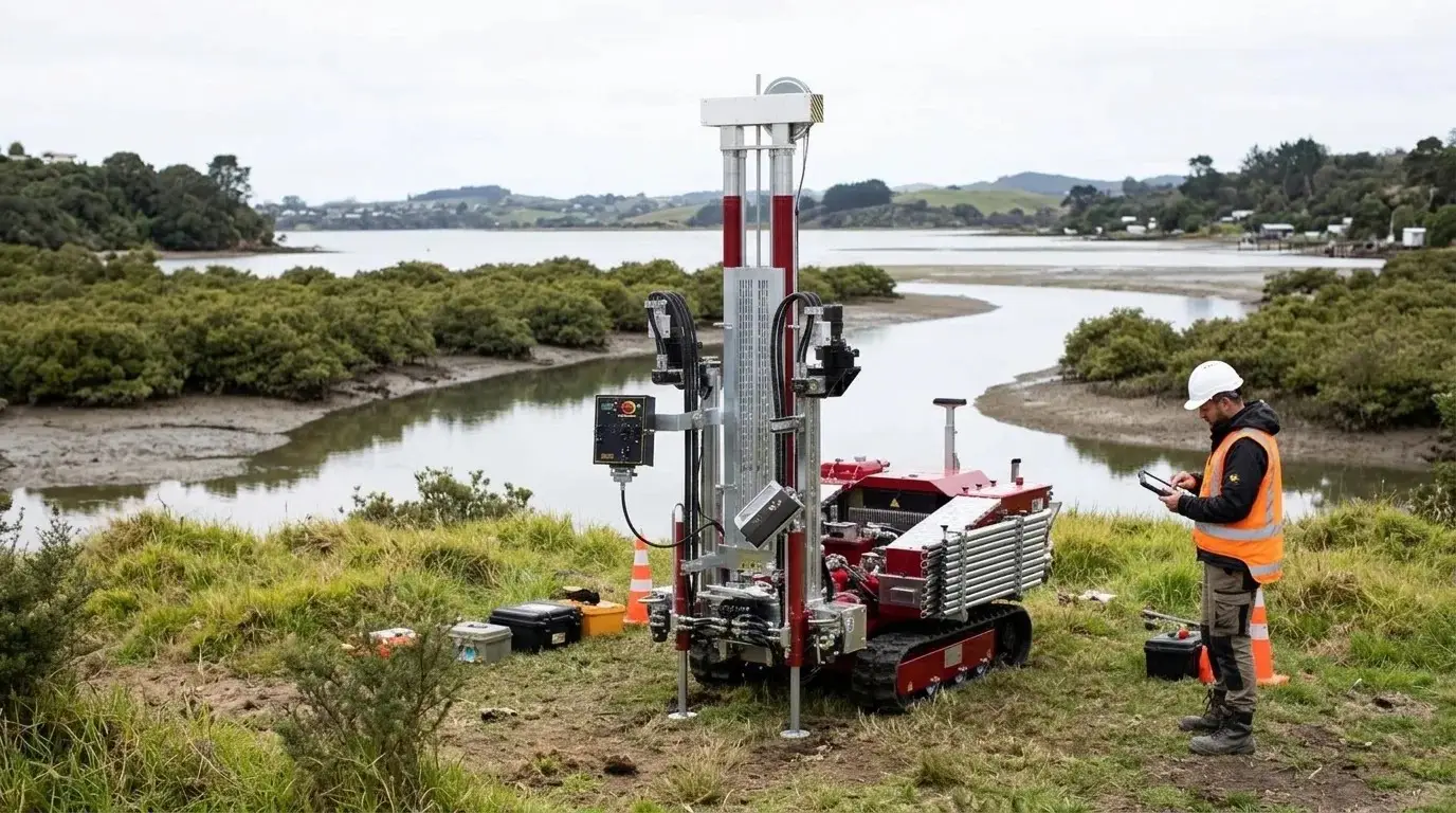
- Cone penetration tests (CPTs). A CPT pushes an instrumented cone into the ground and records a continuous profile of soil type and density. It is the standard tool for liquefaction work because it picks up thin loose layers that other methods can miss.
- Groundwater. Liquefaction needs saturated soil, so the depth to groundwater matters a lot. We measure it where we can and allow for seasonal changes.
- Boreholes and lab tests, where needed. On some sites we add a borehole to recover samples and confirm soil types.
- Analysis. We work through the likely earthquake shaking for the site and estimate whether each layer could liquefy, how much the ground could settle, and whether lateral spreading is possible near open edges. This follows NZGS/MBIE Module 3 guidance.
On a typical residential site, the field work is often one to three CPTs. The report also gives your structural engineer the seismic site subsoil class, which they need anyway.
What if my site is at risk?
A result showing some liquefaction risk is not the end of the project. It just changes the design. Common responses, depending on how much settlement is predicted, include:
- Stiffer, tied-together foundations (such as a reinforced raft) that can ride out some uneven settlement without serious damage
- Piles taken through the loose layers into firmer ground below
- Ground improvement, such as replacing or densifying the shallow loose soils
- Layout changes on subdivisions, keeping buildings back from stream banks and other open edges where lateral spreading could occur
The earlier you know, the more choice you have. Finding out after the foundations are designed usually means redesign, delays and extra cost.
A practical tip
If your site is low-lying or near water, ask for CPTs as part of your first geotechnical investigation rather than as a separate job later. It is usually cheaper to have the rig on site once, and it means your geotechnical report can answer the liquefaction question at the same time as the foundation question.
How we can help
We carry out seismic and liquefaction assessments across Auckland, as part of a wider geotechnical investigation or on their own. If you’re not sure whether your site needs one, send us the address and we’ll tell you what we’d recommend. Get in touch.